Where are the Outer Banks? Location, Maps, and Facts
When planning a trip to the Outer Banks (OBX), one of the first things to know is its location. Understanding where the Outer Banks are on the map and how difficult they can be to get to will help you decide when to visit, what to pack, and what you can expect when you arrive.
We’ll explore the Outer Banks’ geographic location and how it shapes the area’s climate, culture, and attractions. Plus, we’ll clarify some common questions about the Outer Banks’ location so you’re fully prepared for your coastal Carolina getaway!
As someone who lives in Raleigh and escapes to Duck (in the Outer Banks) multiple times a year, sometimes for a month at a time, I can tell you that the Outer Banks offers something truly unique: a slower pace of life that’s hard to find anywhere else, especially during the off-season.
Disclosure: Some of the links below may be affiliate links. At no additional cost to you, I may earn a small commission if you make a purchase.
The Outer Banks’ Location
When people ask “where are the Outer Banks,” they’re often surprised to learn that these iconic barrier islands stretch for 120 miles along North Carolina’s coast (much longer than most visitors realize). Understanding exactly where the Outer Banks are located and how to find them on a map is all part of planning your visit.
The Outer Banks are positioned between the Atlantic Ocean to the east and a series of protected sounds to the west, creating a unique geography that has shaped everything from the islands’ culture to their climate. Let’s pinpoint exactly where you’ll find this coastal paradise.
Where are the Outer Banks on the Map?
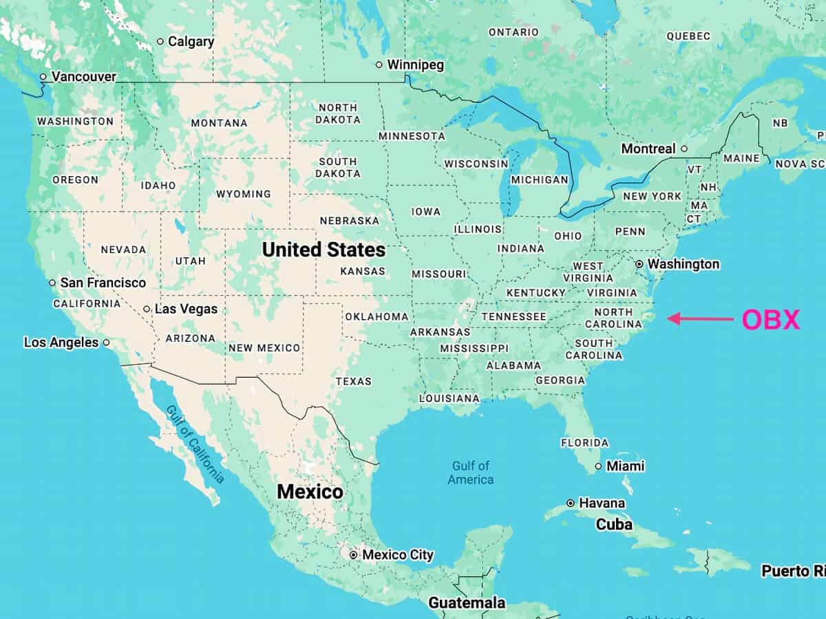
You may know that the Outer Banks are located in North Carolina, but you might still be wondering exactly where they are along the coast. With so many beach towns and coastal areas, it can be tricky to pinpoint, especially where they start and stop.
The Outer Banks are a string of barrier islands located off the coast of northeastern North Carolina. The coordinates are approximately 35.5585° N latitude and 75.4665° W longitude. The islands span across three main counties: Currituck County, Dare County, and Hyde County.
These narrow islands begin at the Virginia border and extend south for approximately 120 miles to Ocracoke Island, creating a natural buffer between the Atlantic Ocean and the mainland sounds. The Outer Banks are often referred to simply as “OBX” by locals and frequent visitors. You’ll see this abbreviation on bumper stickers, t-shirts, and just about everywhere once you arrive!
Fun Fact: Residents even have OBX license plates!

Interactive Outer Banks Map
Use this interactive map to zoom in and explore the Outer Banks’ location along the North Carolina coast and its place on a larger scale.
What State and Country are the Outer Banks in?
State: North Carolina, United States
Country: United States of America
Continent: North America
The Outer Banks are firmly part of the United States, specifically North Carolina (with a small northern section extending into Virginia near Virginia Beach). No passport required for U.S. citizens!
Where are the Outer Banks in North Carolina?
The Outer Banks are located in the northeastern corner of North Carolina, stretching along the Atlantic coast. They’re positioned between the Atlantic Ocean to the east and a series of sounds (Albemarle, Pamlico, Croatan) to the west.
Geographic Position:
- State: North Carolina (with a tiny portion extending into Virginia)
- Region: Coastal Plain
- Direction from Raleigh: East/Northeast, about 200 miles
The islands are part of the Atlantic Coastal Plain and represent one of the most dynamic coastal environments in the United States due to constant interaction with ocean currents and storms.
What County are the Outer Banks in?
The Outer Banks span three NC counties, each with its own character.
Currituck County (Northern Outer Banks)
- Includes: Corolla, Duck, Southern Shores
- The northeastern-most county in North Carolina
- Formed in 1668, gained county status in 1739
- Name comes from the Indian word “Coratank,” meaning wild geese
Dare County (Central Outer Banks)
- Includes: Kitty Hawk, Kill Devil Hills, Nags Head, Manteo, Rodanthe, Avon, Buxton, Hatteras
- The heart of the Outer Banks tourism industry
- 800 square miles total, 391 square miles of land
- Elevation: 11.3 feet
- Named after Virginia Dare, the first English child born in America
Hyde County (Southern Outer Banks)
- Includes: Ocracoke Island
- Ocracoke is 13 miles long and 2 miles wide
- Most remote inhabited island of the Outer Banks
- The entire island except the village is owned by the National Park Service
About the Outer Banks
Now that you know where to find the Outer Banks on a map, let’s dive into what makes this coastal destination so special. From the origin of its name to the unique climate shaped by its Atlantic location, the Outer Banks offer a perfect blend of natural beauty, history, and laid-back culture.
Understanding this more will help you appreciate why more than 5 million visitors flock here each year.
Why is It Called the Outer Banks?
The name “Outer Banks” comes from the islands’ geographic position as the outermost barrier islands protecting the North Carolina coast. They form an outer perimeter between the Atlantic Ocean and the mainland sounds.
These barrier islands act as a natural defense system, absorbing the impact of storms and hurricanes before they reach the mainland. The constant reshaping by wind, waves, and storms gives the Outer Banks their distinctive narrow, elongated shape.
The name has been used for centuries, though the area has gone by various names throughout history, including “Banks” by early colonists.
What Makes the Outer Banks So Special?
Having spent considerable time in Duck and the surrounding areas over the years, I can tell you the Outer Banks offer something truly unique.
Natural Beauty
- Pristine beaches: The main appeal for most visitors are the miles of undeveloped shoreline, especially within Cape Hatteras National Seashore
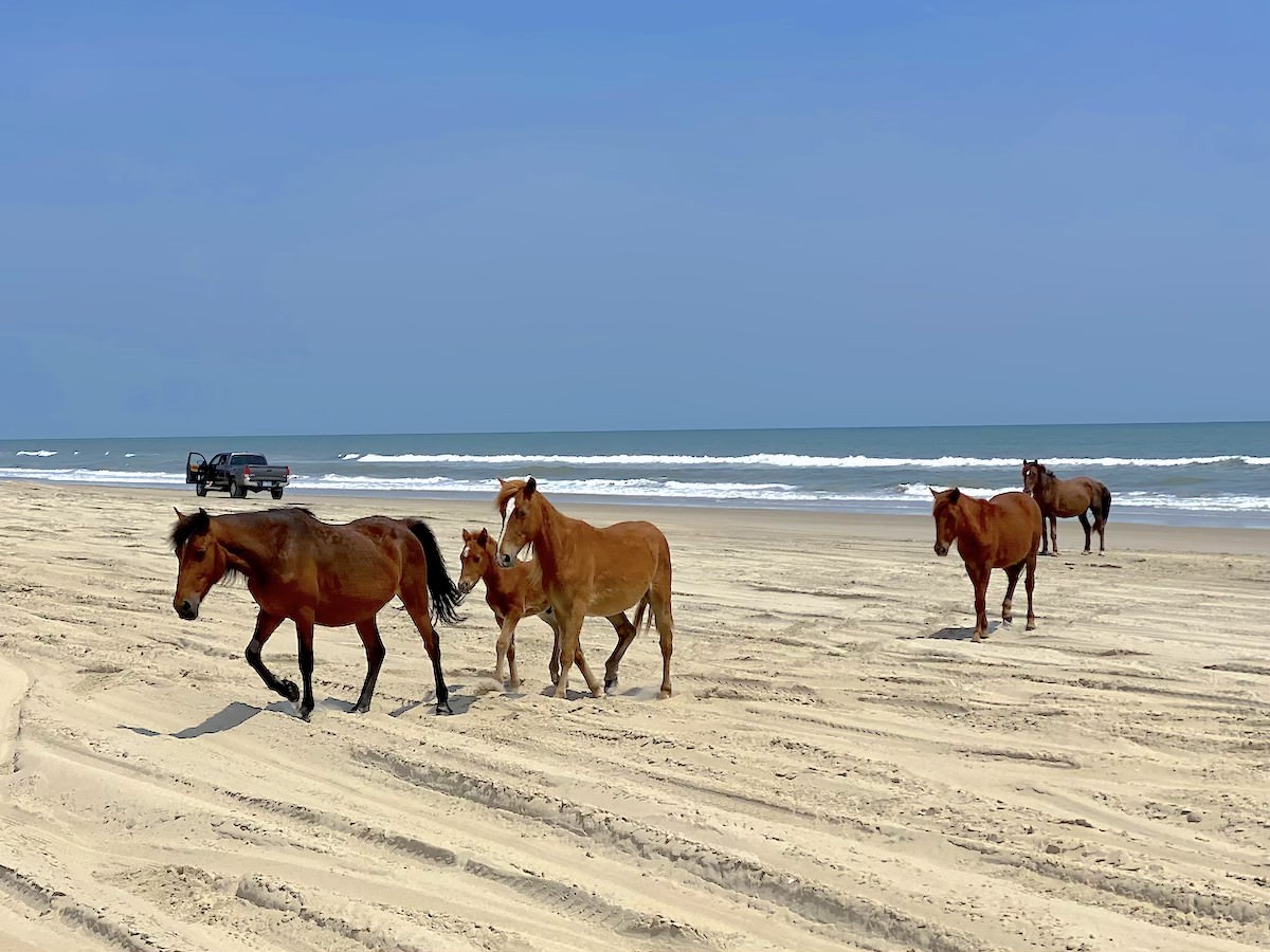
- Wild horses: Descendants of Spanish mustangs roam freely in Corolla
- Jockey’s Ridge: The tallest natural sand dune system in the Eastern U.S.
- Stunning sunrises: Over the Atlantic Ocean
- Unique ecosystems: Maritime forests meet sand dunes and marshes
History
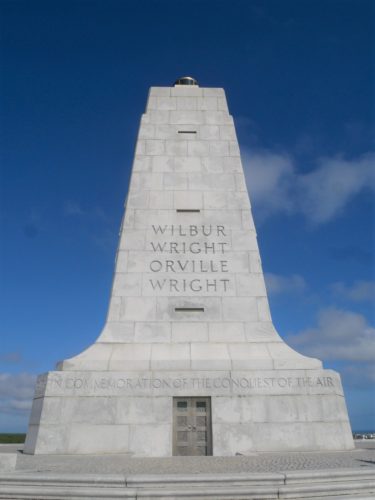
- Wright Brothers National Memorial: Site of the first powered flight in 1903
- Roanoke Island: The “Lost Colony” and birthplace of Virginia Dare
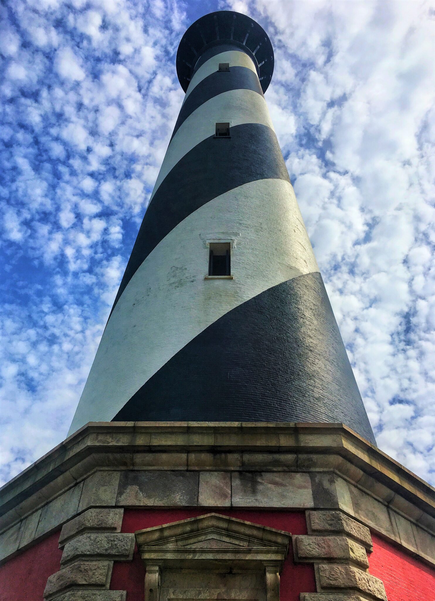
- Cape Hatteras Lighthouse: America’s tallest brick lighthouse
- Shipwreck history: Known as the “Graveyard of the Atlantic”
Laid-Back Culture
- Small-town vibe: Even during peak season
- Fresh seafood: Locally caught and incredibly fresh
- Water sports paradise: Surfing, kiteboarding, fishing, kayaking
- Dark skies: Limited light pollution for stargazing
The Slower Vacation Pace of Life
What I love most about the Outer Banks, especially Duck, is how it forces you to slow down. There’s no pressure to rush from place to place. You fall into a rhythm of morning beach walks, afternoons on the beach, and evenings watching the sunset from the boardwalk. It’s the perfect antidote to the busy pace of daily life.
If you can visit in off-season, you’ll also get to experience the area like a local, and I have to say… it’s pretty charming!
What Cities and Towns are Closest to the Outer Banks?
The closest cities to the Outer Banks aren’t technically on the barrier islands themselves, but there are several key hubs worth knowing about.
On the Outer Banks
The largest towns within the OBX area, often considered the central hubs, include:
- Kitty Hawk: Near the northern mainland bridges
- Kill Devil Hills: The most populous year-round settlement in Dare County
- Nags Head: A major tourist destination with iconic attractions
- Duck: A quieter, more upscale village (my personal favorite!)
- Corolla: The northernmost town, known for wild horses
- Hatteras Village: On Hatteras Island to the south
- Ocracoke: The southernmost village, accessible only by ferry
Nearby Mainland Cities
- Elizabeth City: To the northwest, about 50 miles from the northern beaches
- Manteo: On Roanoke Island, technically between the OBX and mainland
- Norfolk, Virginia: About 90 miles north, home to the closest major airport
Planning Tip: The Outer Banks offer enough activities to keep you entertained for a solid week. However, if you want to explore the full length from Corolla to Ocracoke, consider setting aside 10 to 14 days. Each area has its own feel and it’s hard to do the full length in just one day!
How the Outer Banks’ Location Affects Its Climate
The Outer Banks’ position along the Atlantic coast creates a unique climate that’s generally milder than inland North Carolina.
We’re talking:
- Warm summers with ocean breezes keeping temperatures comfortable.
- Mild winters compared to inland areas.
- Hurricane season from June to November (the islands are IN the hurricane belt).
- Year-round destination with distinct seasonal experiences.
The surrounding ocean moderates temperatures, keeping summers from getting too hot and winters from getting too cold. However, the lack of geographic barriers means the islands can experience strong winds year-round. It also is quite susceptible to storms.
This means a little bit of rain and wind and the main road (and only road for much of the northern and southern parts) can be underwater. Or, perhaps you’ve seen the recent news stories about houses falling in to the ocean in Buxton. This area is always changing!
Off-Season Magic: I absolutely love visiting the Outer Banks in the off-season (late fall through early spring). The pace of life slows down dramatically, you have the beaches mostly to yourself, and the sunrises are absolutely spectacular without the summer crowds. Just pack layers to deal with the breeze on the beach!
Geographic Highlights of the Outer Banks
The Outer Banks’ unique geography creates some unforgettable landmarks.
- Cape Hatteras National Seashore: 70 miles of protected beaches, offering some of the most pristine and undeveloped coastline on the East Coast. Perfect for those who want natural beauty without commercial development.
- Jockey’s Ridge State Park: Home to the tallest natural sand dune system in the Eastern United States, with dunes reaching up to 100 feet. A favorite spot for hang gliding and sandboarding.
- Pea Island National Wildlife Refuge: A haven for migratory birds and wildlife, offering exceptional birdwatching opportunities.
- Oregon Inlet: A dynamic inlet connecting Pamlico Sound to the Atlantic Ocean, popular for fishing and known for strong currents.
- Corolla’s Wild Horses: These beautiful Spanish Mustangs roam freely in the northern 4WD areas, descendants of horses that survived shipwrecks centuries ago.
- Croatoan Sound: The calm western waters perfect for kayaking, paddleboarding, and sailin are perfect for when ocean conditions are rough.

Exploring the Outer Banks
Once you’ve decided to visit the Outer Banks, the next questions naturally focus on the practical logistics: How do you get there? How big is it? What’s the best way to explore? This section covers everything you need to know about navigating the Outer Banks, from choosing your arrival method to understanding drive times and ferry schedules.
Whether you’re planning to drive from Raleigh (like I do), fly into Norfolk, or explore the entire 120-mile stretch, here’s what you need to know to make the most of your visit.
How Big are the Outer Banks?
The Outer Banks stretch for approximately 120 miles from the Virginia border down to Ocracoke Island. However, these barrier islands are remarkably narrow.
Width: The islands range from just 2 to 9 miles wide in most places, with some sections barely half a mile across. This narrow profile is part of what makes the OBX so unique. You’re never far from either the ocean or the sound.
Total Area: Dare County alone covers 800 square miles, though only 391 square miles is land (the rest is water).
Despite their relatively small size, the Outer Banks pack an incredible amount of diversity. From the towering sand dunes of Jockey’s Ridge to the untouched beaches of Cape Hatteras National Seashore, there’s always something new to discover.
Can You Drive to the Outer Banks?
Yes! You can absolutely drive to the Outer Banks, and it’s one of the most popular ways to visit due to their fairly remote location. Being 120 miles long, it may be surprising to learn that there are only 2 main bridges that connect the barrier islands to the mainland.
- Wright Memorial Bridge (US-158): Connects from Point Harbor to Kitty Hawk
- Virginia Dare Memorial Bridge (US-64): Connects from Manns Harbor to Manteo/Nags Head
There is however a third bridge in the southern Outer Banks that just connects the barrier islands from one to another. It’s called Bonner Bridge (Replacement) (NC-12). It connects Bodie Island to Hatteras Island.
From Raleigh, it takes about 3.5 to 4 hours to reach the northern beaches (Duck, Corolla) and about 4 to 4.5 hours to reach the central beaches (Nags Head, Kill Devil Hills). I make this drive several times a year, and I can tell you it’s worth every mile!
Important Note: While most of the Outer Banks are accessible by car, Ocracoke Island can only be reached by ferry from either Hatteras Village, Swan Quarter, or Cedar Island.
What City Do You Fly into for the Outer Banks?
Part of why many people drive to the Outer Banks is that the closest major airport to the Outer Banks is Norfolk International Airport (ORF) in Norfolk, Virginia, approximately 90 miles (1.5 hours) from the northern OBX beaches.
Airport Options:
- Norfolk International Airport (ORF): Closest, about 1.5 hours to northern beaches
- Raleigh-Durham International Airport (RDU): About 3.5-4 hours drive
- Coastal Carolina Regional Airport (EWN) in New Bern: Smaller regional option
Are There Shuttles from Norfolk Airport to the Outer Banks?
Yes! Several shuttle services operate between Norfolk International Airport and the Outer Banks:
- Beach Cab OBX
- Outer Banks Shuttle Service
- Private car services and ride-sharing options
However, most visitors prefer to rent a car at the airport since you’ll need one to get around the islands anyway. Check Discover Cars to find the best rate across 500+ suppliers.
What’s the Best Way to Get Around the Outer Banks?
Once you arrive, having a car is essential. The Outer Banks are spread out over 120 miles, and public transportation is virtually nonexistent.
There are a few more useful things to know. Here are some tips:
- Rent a car: If flying in, you’ll definitely want to rent a vehicle.
- Drive NC Highway 12: This main road connects most of the islands, but it’s only a two lane road much of the distance and can get crowded.
- Plan for ferries: If visiting Ocracoke, factor in ferry schedules.
- 4WD vehicles: In some areas, like Northern Corolla, you can drive on the beach. If you plan to do so, get a 4WD vehicle.
- Biking: Great for getting around within individual towns like Duck or if you’re a distance biker, you can get quite a distance on the flat roads.
Fair warning, during peak summer season, traffic on NC-12 can get congested, especially around Kill Devil Hills and Nags Head or on Saturday and Sunday which are typical change over days for most of the rental houses. Plan accordingly!
Search Discover Cars for a rental car.
How Long Does It Take to Drive the Entire Outer Banks?
Without stops, you can drive from Corolla to Hatteras Village in about 2.5 to 3 hours. However, this doesn’t include:
- Ferry wait times to Ocracoke (add 1+ hours)
- Traffic during summer (can add significant time)
- Stops at attractions, beaches, or restaurants
If you’re planning to see everything from Corolla down to Ocracoke, I’d recommend spreading it across several days to truly enjoy each area’s unique character. In fact, I’d recommend you stay centrally and then take a day or two to go south and another day or two to go north. This way you can enjoy your exploration and see the best of the Outer Banks.

How Long is the Outer Banks Ferry Ride to Ocracoke?
Ferry times to Ocracoke vary depending on your departure point:
Hatteras to Ocracoke Ferry
- Duration: Approximately 60 minutes
- Frequency: Runs multiple times daily (every 30-60 minutes in summer)
- Cost: FREE!
- No reservations needed for this route
Swan Quarter or Cedar Island to Ocracoke
- Duration: Approximately 2.5 hours
- Reservations required. Make them here.
- Cost: Varies by vehicle size
The Hatteras-Ocracoke ferry is the most popular route and offers beautiful views across Pamlico Sound. I recommend arriving early during peak season as ferries can fill up!
Where is Outer Banks Filmed?
If you’re a fan of the Netflix series “Outer Banks,” you might be surprised to learn that the show is NOT actually filmed in the Outer Banks!
Actual Filming Locations:
- Charleston, South Carolina: Most of seasons 1-3
- Barbados: Standing in for the Bahamas in season 2
- Morocco: Season 4 finale
- Wilmington, North Carolina: Some season 4 scenes (the show’s first time filming in NC)
Why Not Film in the Real OBX?
The show’s creators originally planned to film in North Carolina but ultimately chose Charleston due to better tax incentives and filming infrastructure. Season 4 did include some North Carolina locations, including Fort Fisher and Wrightsville Beach near Wilmington, marking the show’s first appearance in the state it’s named after!
Fun Fact: While the show takes creative liberties with geography and combines locations, it has introduced millions of viewers to the magic of North Carolina’s coast and sparked renewed interest in visiting the real Outer Banks.
Explore More of the North Carolina
So… can you now answer where the Outer Banks are? I certainly hope so! The Outer Banks’ location along North Carolina’s coast makes them a fantastic destination for travelers seeking beautiful beaches, rich history, and that unique slower pace of coastal life.
Whether you’re watching wild horses in Corolla, climbing the Cape Hatteras Lighthouse, or simply relaxing on the beach in Duck, the Outer Banks offer an unforgettable experience that keeps visitors coming back year after year—myself included!
Here are some additional articles to help you plan your trip to North Carolina:
- Where are the Outer Banks? Location, Maps, and Facts
- Meet Duck, NC: My Favorite Town in the Outer Banks
- The 4 Best Places to Get Coffee in Duck, North Carolina
- 20 Best Museums in Raleigh, North Carolina
- The 10 Best Bars in Downtown Raleigh, NC
- Best Bed and Breakfasts in Durham, North Carolina
- 24 Best Wake Forest Restaurants: Where to Eat in Wake Forest, NC
- 16 Best Downtown Raleigh Restaurants: Where to Eat in Raleigh
- 10 Best Beaches in North Carolina: Best Beaches for All Occasions
- How to See Wild Horses in the Outer Banks of North Carolina
Have you visited the Outer Banks? What’s your favorite town or area? Share your experiences in the comments below!
Like this post? Pin it.